Wednesday, December 29, 2010

World Amazing Lake (Part 1)

1. Lake Garda, Italy

Lake Garda is Italy's largest lake. The southern shore is home to hot springs and resort towns laced with pastel villas and terra-cotta-roofed hotels


2. Plitvice lake, Croatia

The 16 blue-green Plitvice Lakes, which are separated by natural dams of travertine, are situated on the Plitvice plateau. Waterfalls connect the lakes, and the tallest waterfall is Veliki Slap at 70 meters (230 feet) tall. The Plitvice lakes area boasts a large variety of interesting and colorful flora and fauna. Visitors can enjoy walking and hiking the many pathways and trails, or exploring the lakes by boat. The park itself has 3 hotels and a campsite, otherwise visitors can find accommodation at any of the number of villages and cities nearby.


3. Lake Bled, Slovenia

At Slovenia's Lake Bled, you'll see mountains in every direction, including the Julian Alps and the Karavanke range. The best view of Lake Bled is from a castle perched on a 460-foot-high cliff. Bled Island is a tiny forested circle that's home to the 17th-century Church of the Assumption.


4. Loch Lomond, Scotland

Scotland's Loch Lomond is like something straight out of a Victorian romance novel. The 24-mile-long lake is dotted with islands, some so small that they disappear when the water levels are high, and others large enough to be (sparsely) inhabited. Most ferries stop at the largest island, Inchmurrin (population 10), so visitors can get a look at the remains of a 7th-century monastery and the 14th century Lennox Castle, used often as a hunting lodge for kings.


5. Lake Annecy, France

This alpine lake is in the heart of the French Alps. Lake Annecy is all about activity —particularly in August, when Paris shuts down and the French take extended holidays. Sailors, kayakers, and water-skiers crisscross the water; bikers and hikers hit surrounding nature trails; and refugees from the city fill the outdoor tables at the lakeside restaurants and bars. Repeat visitors know to plan their trip for the first Saturday of August, when a staggering, nearly two-hour-long fireworks display illuminates the water.

Saturday, December 18, 2010

Mysterious Stonehenge, England

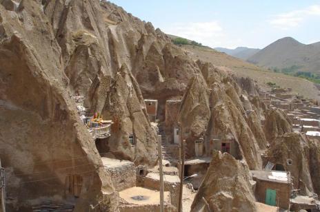
Stonehenge is a mysterious stone Monument in the county of Upshur in England. No one knows what is the purpose of this Stonehenge, whether it’s a court, or place of worship, or temple, or perhaps a sign of a UFO? There are many hypothesis and interpretations by many researchers. 


Stonehenge, the most visited and well known of the British stone rings, is a composite structure built during three distinct periods. In Period I (radiocarbon-dated to 3100 BC), Stonehenge was a circular ditch with an internal bank. The circle, 320 feet in diameter, had a single entrance, 56 mysterious holes around its perimeter (with remains in them of human cremations), and a wooden sanctuary in the middle. The circle was aligned with the midsummer sunrise, the midwinter sunset, and the most southerly rising and northerly setting of the moon. Period II (2150 BC) saw the replacement of the wooden sanctuary with two circles of ‘bluestones’ (dolerite stone with a bluish tint), the widening of the entrance, the construction of an entrance avenue marked by parallel ditches aligned to the midsummer sunrise, and the erection, outside the circle, of the thirty-five ton ‘Heel Stone’. The eighty bluestones, some weighing as much as four tons, were transported from the Prescelly Mountains in Wales, 240 miles away.


During Period III (2075 BC), the bluestones were taken down and the enormous Sarsen stones - which still stand today - were erected. These stones, averaging eighteen feet in height and weighing twenty-five tons, were transported from near the Avebury stone rings twenty miles to the north. Sometime between 1500 and 1100 BC, approximately sixty of the bluestones were reset in a circle immediately inside the Sarsen circle, and another nineteen were placed in a horseshoe pattern, also inside the circle. It has been estimated that the three phases of the construction required more than thirty million hours of labor. Recent studies indicate it unlikely that Stonehenge was functioning much after 1100 BC.


Current theories regarding the purpose of Stonehenge suggest its simultaneous use for astronomical observation and ritual function. By gathering data regarding the movement of celestial bodies, the Stonehenge observations were used to indicate the appropriate days in the annual ritual cycle. In this regard, it is important to mention that the structure was not used only to determine the agricultural cycle, because in this region the summer solstice occurs well after the growing season begins and the winter solstice well after the harvest is finished. Concerning its architectural form and function, scholars have suggested that Stonehenge, especially in its middle and later form, was intended to be a stone (and thereby imperishable) replica of the kind of wooden sanctuary that was more locally common in Neolithic times. What was the nature of the rituals performed at Stonehenge? Ray theorizes that, because Stonehenge is situated in an area rich in burial tombs, it may have had some relevance in burial rituals. Its shape, which resembles that of Neolithic ceremonial buildings, however, points more to its probable use as a shrine for the living rather than for the dead. As a temple for the living, Stonehenge's capacity to determine the dates of the solstices and equinoxes becomes all-important. Throughout the ancient world people have regarded the sun and moon as sacred beings whose cyclical rhythms, with their seasonal strengthening and weakening, had a positive, magical, and rewarding effect upon the life of human beings. Stonehenge and the large number of other stone rings located throughout the British Isles (and the world) are part solar/lunar/stellar observatory and part ritual structure. The mystery remains: Why?


Myths and legends of Stonehenge shed light on the nature of the activities and ceremonies performed at the festivals. For example, the legendary Merlin tells King Aurelius:

Laugh not so lightly, King, for not lightly are these words spoken. For in these stones is a mystery, and a healing virtue against many ailments. Giants of old did carry them from the furthest ends of Africa and did set them up in Ireland what time they did inhabit therein. And unto this end they did it, that they might make them baths therein whensoever they ailed of any malady, for they did wash the stones and pour forth the water into the baths, whereby they that were sick were made whole. Moreover they did mix confections of herbs with the water, whereby they that were wounded had healing, for not a stone is there that lacketh in virtue of leechcraft.

And Layamon, a 13th century British poet, also speaks of the healing quality of Stonehenge.

The stones are great
And magic power they have

Men that are sick
Fare to that stone
And they wash that stone
And with that water bathe away their sickness


Wednesday, December 15, 2010

8 Most Amazing Street In The World

1. Most Confusing Roundabout in the world (Magic Roundabout – Swindon, UK)

The Magic Roundabout in Swindon consists 5 mini-roundabouts that is arranged in a circle. It was constructed since 1972 and it had been stated as 4th scariest junction in UK

2. Widest Street in the world (9 de Julio – Buenos Aires, Argentina)

9 de Julio is a name of street in Buenos Aires to celebrate the victory of the country in July 9, 1816. It is 9 lanes wide from left to right side and the street is embellished with huge Obelisk on the center of the street. There are 2 traffic lights on every intersection. It will safe any pedestrians from accident.

3. Largest Roundabout in the world (Putrajaya – Malaysia)

The roundabout spans 3.4 km circling Persiaran Sultan Salahuddin Abdul Aziz Shah include Prime Minister’s office, Istana Melawati, Putra Perdana Landmark, and Putrajaya Shangri-La Hotel. The roundabout situated around a beautiful hill and green parks.

4. Most Complicated Interchange in US (Judge Harry Pregerson Interchange – Los Angeles)

Judge Harry Pregerson interchange was opened since 1993 to solve traffic problem around LA. The interchange is stacked with layers of bridges and 4 level interchange. The entry and exit access to all direction is opened at Interchange 105 and the Interchange 110.

5. Most Crooked Road in US (Lombard St – San Francisco)

The weird road could be found in Russian Hill between Hyde and Leavenworth streets, San Francisco. The maximum speed to move above the road is only 5 mph and it is only one way. The street has 27-degree slope and at two sides of the street stand most expensive houses mansions, condominiums, and town houses in San Francisco
Below is another crooked road in San Fransisco, The Vermont Street between 20th St & 22nd St in Portrero Hill. It is less popular because Lombard street is more beautiful than Vermont street


6. Longest Street in the world (Yonge St – Ontario, Canada)

Yonge Street is 1,178 miles or 1,896 km and it was listed in the Guinness Book of World records as the longer street on earth before Pan-America Highway opened for public. Yonge Street spans between Lake Ontario and Lake Simcoe in Ontario.

7. The Narrowest street in the world (Spreuerhofstraße – Germany)

Spreuerhofstraße is addressed at Reutlingen, Baden-Württemberg, Germany, and is known as the narrowest street in the world because the street is only 12 cm and 50 cm wide. The street itself was built since 1727 and it is officially listed in the Land-Registry Office since that year as City Street Number 77.

8. The Steepest Street in the world (Baldwin Street – New Zealand)

Baldwin street is addressed at 3.5 kilometers northeast of Dunedin’s city, New Zealand. The length is only 350 meters and it is enough to make it to be known as the steepest street in our planet. The upper reaches is made of concrete instead of Asphalt. For every 2.86 meters length horizontally, the elevation rises 1 meter higher. 

Saturday, December 11, 2010

Amazing Rock-Carved Houses at Kandovan Village in Iran

Kandovan (also spelled Candovan) is a tourist village near Osku and Tabriz, Iran. The architectural history of Kandovan dates back to the 13th century. In this unique village, the homes are not just built on the mountain, they are carved into it. Built out of volcanic ash and debris spewed during an eruption of Mount Sahand, these rocky structures were compressed and shaped by natural forces into cone-shaped pillars containing pockets. They have been eroded by the elements over the years into their current shapes. This makes the complete village looks like a gigantic termite colony.


Some of these houses are at least 700 years old and still inhabited. Most of the houses are two to four storeys high. Legend is that Kandovan’s first inhabitants moved here centuries ago to escape from the invading Mongol army. Local residents say that the homes are not only strong but also unusually ‘energy efficient’: These homes require minimal supplemental heat during the long cold season and remain cool in the summer. 'Kando' means 'a bee’s hive’, and this is how Kandovan got its name.


Despite the village’s isolated nature, tourists from around the world can be found wandering in narrow streets, impressed by this old place. Those not necessarily wanting to stay in caves don’t have to worry about their stay - this rocky village has a five-star-rock hotel called Laleh Hotel. It is decorated with traditional Iranian furniture and is the third 'rocky' hotel in the world. This 40-room hotel is inspired by the traditional building methods of Kandovan. You will be amazed to have a bed, a TV room Kitchen and even Jacuzzi, all inside a rock.


Far away from pollution and noisy metropolitan cities, this stone village helps people relax. It makes us believe that cave living is by no means uncomfortable. A quiet place for those who are looking for peace and comfort.

Tuesday, December 7, 2010

The Amazing Rock City in Setinil, Spain

Setinil, Spain. Strange City Situated Between Rocks
Setenil de las Bodegas is about 18 km away from Ronda in the province of Cadiz, has wedged itself between the cliffs eroded by the Rio Trejo river. This village is built in a valley, and many of the houses especially the old one are built into the cliff, so the back of the house is solid rock. While the newer houses are against the hillside.

The name Setenil developed from the the Latin septem nihil – “seven times no” – which refers back to the period of the Christian reconquest, when Catholic kings tried to win back territory from the Moors, who had come from Africa and ruled the Iberian peninsula since 711. In Setenil’s case, only the seventh reconquest attempt was successful, in 1485, making the city one of the last bastions of the Moors until they were driven out of western Europe in 1492.